
Dover’s Foreign Commerce
The following statement will give the reader some idea of the commercial business of Dover in the year 1700, at Dover Neck. The ship masters carried merchantable cod fish to the markets of Spain, Portugal, the Straits, and cities along the coast of the Mediterranean Sea. To the West Indies they carried much fish and lumber; the later being large quantities of pipe staves for the sugar plantations. In return they carried cargos from there to England, of sugar, molasses, cotton, logwood, etc. to England they sent direct quantities of ship timber, various furs, deer, bears, beavers, etc. In return they brought home English goods of various sorts, which were in demand in the home market and in other towns along the coast.
To Virginia the clumsy little sloops and ketches of Dover merchants and ship owners carried molasses, rum, salt, cider, mackerel, wooden bowls, platters, pails, kegs, which were made at the carpenter shops on Dover Neck, and a good supply of salt fish, the product of Dover fishermen. In return they brought back wheat, salt pork, tobacco, furs and hides, Indian corn, old pewter, brass, copper, etc.
The craft which crossed the Atlantic, and made the West Indies in safety were not very large vessels, but they had to encounter the storms that prevailed in that period just as they do in these modern times. Old Ocean was just the same then as now. It is said that some of those old masters made their voyages without sextant or “Practical Navigator.” An old writer had described their method in a somewhat exaggerated style as follows: --
“The skippers kept their reckoning with chalk on a shingle, which they stowed away in the binnacle; and by way of observation they held a hand up to the sun. When they got him over four fingers they knew they were straight for Whole in the Wall; three fingers gave them their course to the doubled headed Shop Key; two fingers carried them down to Barbadoes.”
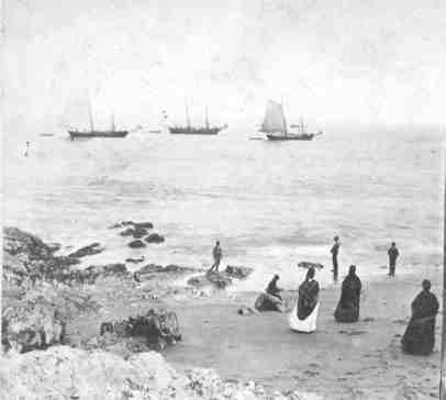
These vessels were of 40 and 60 tons burden, mere cockleshells for deep water voyaging, but they withstood the storms and evaded capture by the pirates who infested the sailing courses of the ships of the period. They were commanded by hardy, keen minded and fearless men, in the beginning, and voyaged farther and farther away from Dover, as profitable trade lured them on and on.
In those early days the troublous pirates, or Corsairs, had begun to vex and trouble the New England skippers who boldly crossed the Atlantic in vessels, some of which were not larger than a common brick barge of the 19th century. These “Sallee Rovers” kept watch from the Mediterranean, at the Straits of Gibraltar, to the chops of the English Channel. Many a luckless seaman of Dover was held prisoner in the cities of Algiers, while his friends at home endeavored to gather funds to pay the price of liberty and get him home again.
Dover was a town in Massachusetts till 1680; there was not any New Hampshire town before that date. It is on record that in 1661, and for a long time previous, the commerce of Massachusetts was much annoyed by Barbary Corsairs, and that many of its seamen were held in bondage, till the bounty was paid, and they were permitted to return home. In 1700 Benjamin Alford of Boston and William Bowditch of Salem related that—“their friend, Robert Carver of Salem was taken nine years before, a captive into Sally; that contributions had been made for his redemption; that the money was in the hands of a man in Salem; that if they had the disposal of it they could release Carver.” In a time later that was done and Mr. Carver came home.
From Dover Public Library's stereopticon collection
Dover’s Intercourse with Barbadoes Island
Barbadeoes, or Barbadoes Island, is isolated from the rest of the Windward and West Indies in more senses than one. It is 95 miles form the nearest point in the Caribbees, which is the southern end of St. Lucia, and the intervening space sinks to a depth of 8,000 feet. It is still further from Tobago, and the continental system of South America. The depth of water between the Islands and continent is enormous.
Barbadoes is the flattened top of a vast volcanic cone, lifted during the reign of Chaos and Old Night by the Tytanic forces at work in the depths, where Mother Earth had her Electrical Engineering Shop, during the period when the West Indies were being formed. The finishing touches were put on by the corals which built up enormous reefs.
Barbadoes Island is 21 miles long from north to south, and its widest point is about 14 miles across, expanding into a pear shape, It is 55 miles around the shore, not following the indentations, and contains 166 square miles. A low ridge runs through the center from north to south. It has on mountain, Mt. Hillaby, which is1,145 feet high; the surface is undulating, with great variety of hill and dale, of the gentler kind, not having any of the abrupt declivities and wild ravines, such as are characteristic of the Antilles. It is a rolling country and the soil is very prolific; the landscape is variegated with a luxuriant verdure, which makes it look very much like England.
This island was first take possession of by the English and they settled it, scarcely any other nationality being there, except the negro slaves. The English always held it, without any contest with other nations, in all the wars and revolutions that have occurred around it. The English began to settle there about the same time that they began business on Dover Neck; some of them may have been neighbors in the old Home; their descendants kept up the acquaintance through several generations, by way of trade, with vessels frequently going back and forth between the island and New England.
The first settlers in Barbadoes raised corn, yams, sweet potatoes, etc. The cultivation of the sugar cane was introduced from South America in 1641; this soon became the chief business and the manufacture of sugar amassed great fortunes for the planters. Indigo, cotton, tobacco and ginger were also largely produced. Molasses and rum, in time, became by-products of the sugar cane, and it is said these were both very popular commodities in Dover for many years. It was fashionable to use that beverage in those days.
The success of the cultivation of the sugar cane soon drew money and men to the island to engage in the business. Dover men not only went down there in their ships to trade, but quite a number invested in the sugar business, by which they acquired much wealth. Robert Nanny, one of the signers of the Combination paper of 1640, in the old log meeting house, purchased a plantation there and settled on it to manage it himself. Thomas Beard, another Dover Neck man, was resident there in 1668, having a large estate on which he resided. It is the tradition that members of the Hanson family made investments there, with satisfactory returns; and one married an English lady who became the maternal ancestor of one branch of the succeeding Hanson family in Dover, and has honored descendants here now.
One of Dover’s historic spots is Barbadoes Pond, most persons, who have thought anything about it, have wondered why in the world such a name was given to that beautiful little pond of water. The explanation is this: Some enterprising merchant or some thrifty sea captain, who had grown rich in his trade with Barbadoes people, was so pleased that he gave the name to a timber lot that the town had granted to him. It was a custom adopted in the earliest times in Dover to thus name land grants, to fix something for a record where to find it, and locate other lots, as they were granted. Originally the name, Barbadoes, was applied to quite a tract of land, but for a long time has been used only as the name of the pond.
A Petition presented to the General Assembly in 1698, by Captain Richard Gerrish of Dover.
The petition of Richard Gerrish of Dover, commander of ye ship “Benjamin,” humbly showeth: “That wheras your petitioner, an inhabitant of this Province, and now commander off said ship, which was built in this River, at Dover, and now bound for Barbadoes, and coming from Boston, where I paid the duty of “Powder Money,” which is again here demanded at Portsmouth; and considering the advantage that has accrued to this place (Portsmouth) by means of ye trade used by said ship, and how hard it would bear on my owners to pay “Powder Money” twice, in one voyage, by my coming here to load; I hymbly pray your honors to remitt ye same, or soe to mitigate itt as may be a furder Incoragement to my Concerne, as also to your Honors’ most Humble servant.” Richard Gerrish.
From History of Dover, New Hampshire. vol. 1. : Containing historical, genealogical and industrial data of its early settlers, their struggles and triumphs by John Scales, c. 1923.